Pomona Loop
Interactive map
GPS track profile
About this GPS track
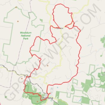
Name: Pomona Loop GPS track, route, trail
Start: Pavilion Street, Pomona, Noosa Shire, Queensland, 4568, Australia (-26.35926 152.85903)
End: Pavilion Street, Pomona, Noosa Shire, Queensland, 4568, Australia (-26.35882 152.85863)
Coordinates: -26.37084 152.81529 -26.22717 152.91031
Other GPS tracks
Click on a GPS track to view route, its statistics and profile.
Yurol State Forest - Yurol Road Crossing
Morning Run
Distance: 10.8 Km • Elevation gain: 146 m • Maximum elevation: 130 m