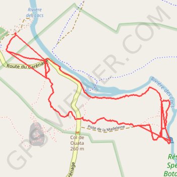
PR SUD - Sentier des Agathis
- Distance: 7.4 Km
- Elevation gain: 99 m
- Maximum elevation: 267 m
- Elevation loss: 103 m
- Minimum elevation: 229 m
Interactive map
GPS track profile
About this GPS track
Name: PR SUD - Sentier des Agathis GPS track, route, trail
Start: Route du Carénage, Yaté, Province Sud, Nouvelle-Calédonie, 98834, France (-22.22463 166.84578)
End: Route du Carénage, Yaté, Province Sud, Nouvelle-Calédonie, 98834, France (-22.22316 166.84650)
Coordinates: -22.23238 166.84577 -22.22315 166.86056
Other GPS tracks
Click on a GPS track to view route, its statistics and profile.
UTNC 80 km
France > Province Sud > Mont Dore
Distance: 81.5 Km • Elevation gain: 3,255 m • Maximum elevation: 596 m