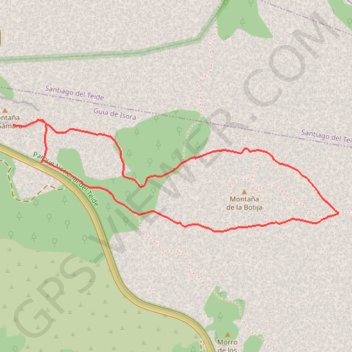
Ten_19_Montana de la Botija - Montana Samara
- Distance: 5.0 Km
- Elevation gain: 246 m
- Maximum elevation: 2,096 m
- Elevation loss: 246 m
- Minimum elevation: 1,870 m
Interactive map
GPS track profile
About this GPS track
Name: Ten_19_Montana de la Botija - Montana Samara GPS track, route, trail
Coordinates: 28.26302 -16.72767 28.26909 -16.70759
Other GPS tracks
Click on a GPS track to view route, its statistics and profile.
Tenerif-06
Distance: 5.0 Km • Elevation gain: 254 m • Maximum elevation: 2,095 m