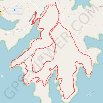
Lake Shore Loop (Lake Norman)
Loop hike along the Lake Norman via Lake Shore Trail, Family Camp Circle and Short Turn Trail in the Lake Norman State Park. #Hike #Loop #Lake #Nature #Forest
- Distance: 5.8 Km
- Elevation gain: 75 m
- Maximum elevation: 256 m
- Elevation loss: 75 m
- Minimum elevation: 234 m
- Moving time: 1 h 8 m
- Moving speed: 5.1 Km/h
- Maximum speed: 9.8 Km/h
- Total time: 1 h 11 m
- Global speed: 4.9 Km/h
- Date: 15/03/2024
Interactive map
GPS track profile
About this GPS track
Name: Lake Shore Loop (Lake Norman) GPS track, route, trail
Start: Shortleaf Drive, Iredell County, North Carolina, United States (35.64949 -80.94399)
End: Shortleaf Drive, Iredell County, North Carolina, United States (35.64958 -80.94409)
Coordinates: 35.64179 -80.94683 35.65024 -80.93796