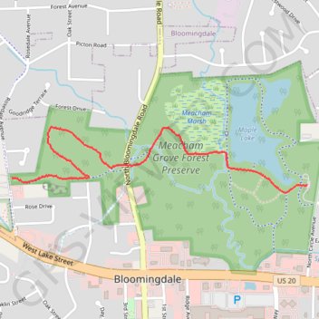
Meacham Grove Forest Preserve
Hike through Meacham Grove Forest Preserve via North Central DuPage Regional Trail and Mapple Lake. #Hike #Nature #Forest #Lake
- Distance: 2.5 Km
- Elevation gain: 10 m
- Maximum elevation: 243 m
- Elevation loss: 31 m
- Minimum elevation: 219 m
- Moving time: 20 m 4 s
- Moving speed: 7.5 Km/h
- Maximum speed: 19.8 Km/h
- Total time: 20 m 4 s
- Global speed: 7.5 Km/h
- Date: 12/02/2024
Interactive map
GPS track profile
About this GPS track
Name: Meacham Grove Forest Preserve GPS track, route, trail
End: Maple Lake Trail, Bloomingdale, DuPage County, Illinois, 60157, United States (41.96187 -88.07095)
Coordinates: 41.96151 -88.08933 41.96456 -88.07095