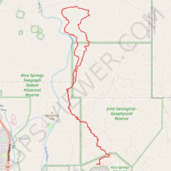
Skyline - Apwelantye Track
Alice Springs Telegraph Station Historical Reserve. #Hike #MTB #Loop #AliceSprings
- Distance: 17.0 Km
- Elevation gain: 186 m
- Maximum elevation: 639 m
- Elevation loss: 186 m
- Minimum elevation: 586 m
Interactive map
GPS track profile
About this GPS track
Name: Skyline - Apwelantye Track GPS track, route, trail
Coordinates: -23.68415 133.89099 -23.63851 133.90625
Other GPS tracks
Click on a GPS track to view route, its statistics and profile.
Old Telegraph Station Trail
Australia > Town of Alice Springs
Alice Springs Telegraph Station Historical Reserve. #MTB #Loop #AliceSprings
Distance: 19.9 Km • Elevation gain: 154 m • Maximum elevation: 643 m