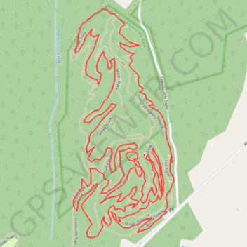
Beechworth Mountain Bike Circuit
Beechworth Historic Park. #MTB #Loop #Beechworth
- Distance: 8.3 Km
- Elevation gain: 231 m
- Maximum elevation: 583 m
- Elevation loss: 231 m
- Minimum elevation: 471 m
Interactive map
GPS track profile
About this GPS track
Name: Beechworth Mountain Bike Circuit GPS track, route, trail
Start: Burke Street, Beechworth, Shire of Indigo, Victoria, 3747, Australia (-36.34342 146.70596)
End: Burke Street, Beechworth, Shire of Indigo, Victoria, 3747, Australia (-36.34342 146.70596)
Coordinates: -36.34445 146.70154 -36.33551 146.70642