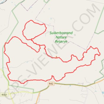
Suikerbosrand Nature Reserve
- Distance: 57.3 Km
- Elevation gain: 1,269 m
- Maximum elevation: 1,901 m
- Elevation loss: 1,271 m
- Minimum elevation: 1,559 m
Interactive map
GPS track profile
About this GPS track
Name: Suikerbosrand Nature Reserve GPS track, route, trail
Coordinates: -26.54639 28.15451 -26.46530 28.29194
Topography: Midvaal Local Municipality topographic map